


search
date/time
Wed, 7:00PM
overcast clouds
20.3°C
WSW 11mph
overcast clouds
20.3°C
WSW 11mph
 | Sunrise | 3:26AM |
| Sunset | 8:47PM |  |
P.ublished 17th June 2026
nature
UK Rivers Face Rising Risk Of Climate ‘Whiplash’
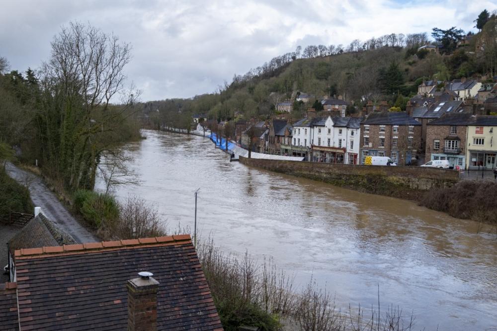
Image by simon-alun-hark0 from Pixabay
Researchers analysed almost 700 river catchments across the UK to project how river flows may change at 2°C and 4°C of global warming.
The results reveal stark regional contrasts and growing challenges for communities and water managers trying to plan for flood and drought risk - particularly in areas that will increasingly experience both.
Publishing their findings today in the journal Earth’s Future, the authors also warn of more intense river flooding during extreme rainfall events in western and northern parts of the UK and longer dry spells and lower river flows in southern and eastern England, regions that are already water‑stressed.
The authors say the findings underscore the need for regionally tailored adaptation, including enhanced flood-risk management and greater capacity to store water during wetter periods in western and northern parts of the UK, and strengthened water-supply resilience and demand management in southern and eastern England.
Our projections show sharper swings between heavy downpours and long dry spells, with river catchments shifting more suddenly from flooding to drought.
These rapid shifts are making water management increasingly difficult, putting pressure on both flood defences and drought-response systems at the same time.
As warming increases, traditional approaches to flood and drought planning may no longer be enough. Instead, region‑specific adaptation strategies will be critical to protect water supplies, infrastructure, ecosystems, and communities.
Dr He added: “Climate change is expected to increase both floods and droughts in many regions, so understanding how these changes will play out locally is crucial for managing water resources and preparing for future risks.”
Increase in whiplash events
Dry-to-wet hydroclimatic whiplash - sudden shifts from dry to wet conditions - may increase the risk of flash flooding, water quality deterioration and soil erosion, while wet-to-dry shifts can make drought planning harder because preceding wet conditions may create a false sense of security before a rapid move into drought.
Projected changes under both 2°C and 4°C warming scenarios show widespread increases in the frequency of both types of whiplash events.
For dry-to-wet whiplash, increases are projected across most of the UK. In some catchments, the number of events rises from around four over a 30-year period in the 1981–2010 baseline to around seven to nine under 4°C warming.
Overall, stronger increases can be observed in South Wales, Northern Ireland, Northern and Western England and parts of southeast England.
UK as a global test case
The modelling provides one of the most comprehensive national-scale assessments to date of how UK rivers may respond to different levels of global warming. The results also show how temperate climates worldwide could face similar shifts.
“The UK’s well-monitored river network and strong regional climate contrasts make it an important test case for temperate regions worldwide,” said Dr He. “Our findings offer insights into how global warming could alter river flows, flood and drought risks, and rapid shifts between wet and dry conditions beyond the UK.”
Under baseline conditions, the middle value across UK catchments for the maximum number of consecutive dry days – an indication of heightened drought risk or conditions associated with drought - is 32.
This increases to 36 days under 2°C warming and 41 days under 4°C.
The most pronounced increases are seen in southern and southeastern England, including the Anglian, Thames, and South East river basin regions, where the maximum number of consecutive dry days could exceed 50 days under 4°C warming.
In contrast, catchments in northern and western Scotland show smaller increases, remaining below 35 days even under the highest warming scenario.
River flooding and rainfall
Western and northern parts of the UK - including Wales, northwest England, western Scotland and parts of Northern Ireland - are projected to see the largest increases in flooding and extreme rainfall, with the strongest rises in extreme rainfall linked to upland and Atlantic-facing catchments.
The largest increase is projected for the Glaslyn at Beddgelert catchment in Snowdonia, North Wales, where maximum one-day rainfall rises by more than 30mm and maximum five-day rainfall by almost 42 mm under 4°C warming.
For river flooding, the study finds that the size of a flood with a 2 per cent chance of occurring in any given year (often called a one-in-50-year flood) generally increases across UK river basin regions. The projected increase is around 20-50 per cent under 2°C warming and six-40 per cent under 4°C warming, with greater regional variation and uncertainty at the higher warming level.
The team used climate projections and a national hydrological model to simulate changes in rainfall, streamflow, and extremes in 698 river catchments across the UK.
They included a range of sizes, topographies, and land uses, spanning across all 23 UK river basin regions.
This work was supported by the Open CLimate IMpacts (OpenCLIM) modelling project funded by the UK Natural Environment Research Council.
‘Escalating Hydroclimatic Extremes and Volatility in the UK Under 2°C and 4°C Warming’ is published in Earth’s Future on June 17.